Log in
All resources
Create a design
33,402 Free Images of 1680 Maps
maps in the library of congress
massachusetts
o. h. bailey
maps by alexandre vuillemin
maps with cartouches
1879 maps of massachusetts
atlas van der hagen
maps in russian state archives of ancient documents
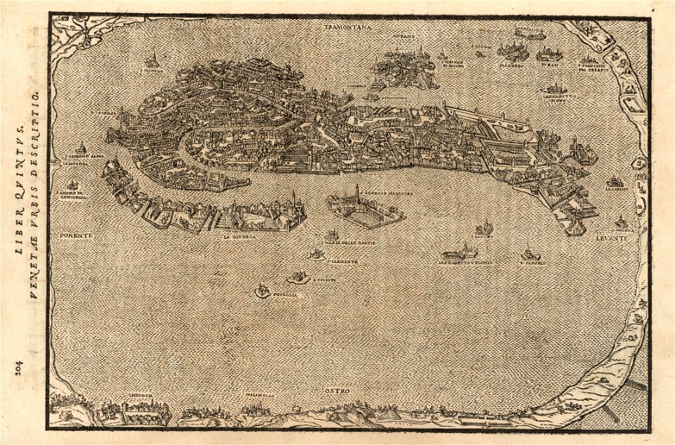
atlante veneto (raremaps.com) volume 2
atlas van der hagen (volume 1)
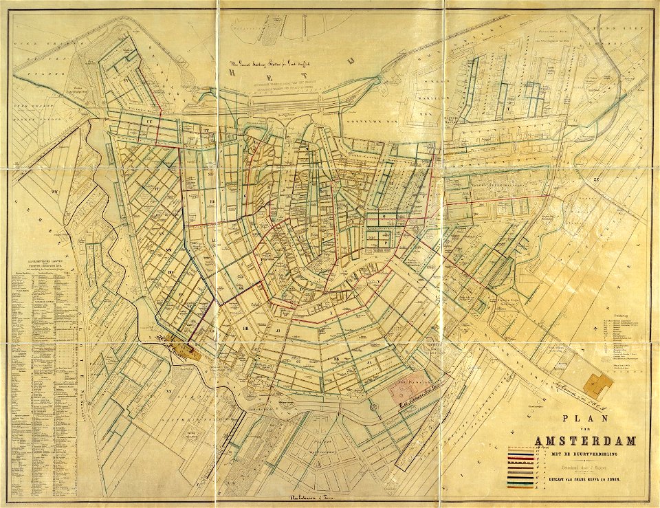
maps in the stadsarchief amsterdam
old maps of amsterdam
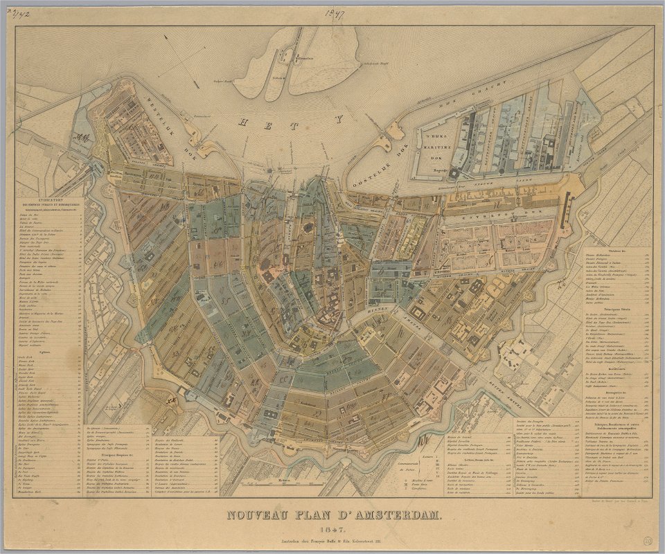
maps in the stadsarchief amsterdam
old maps of amsterdam
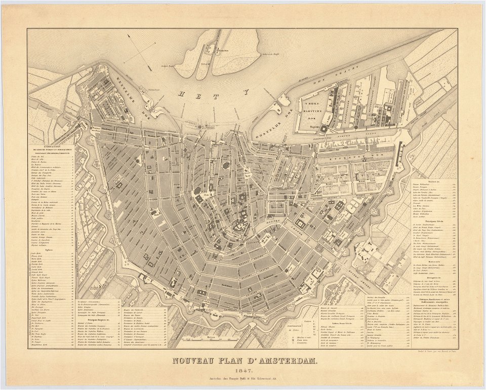
maps in the stadsarchief amsterdam
old maps of amsterdam
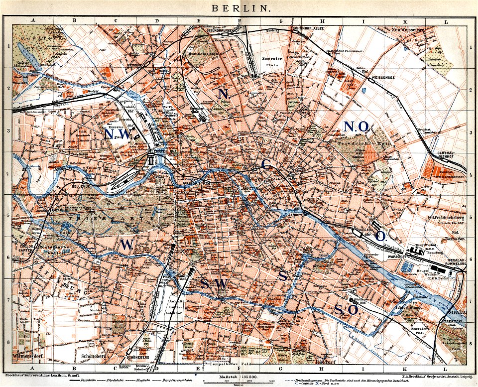
19th-century maps of berlin
maps by brockhaus
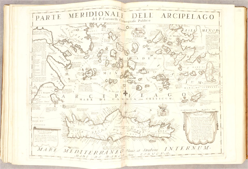
geographical illustrations by coronelli
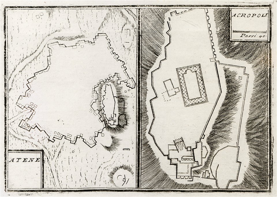
old maps of athens
old maps of the aegean sea
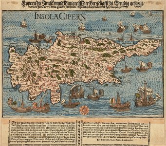
old maps of crete
drawings in the universitätsbibliothek salzburg
maps made in the 17th century
atlante veneto (raremaps.com) volume 2
old maps of île de ré
old maps of the aegean sea
old maps of greece
claes jansz. visscher (ii)
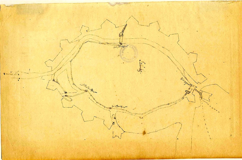
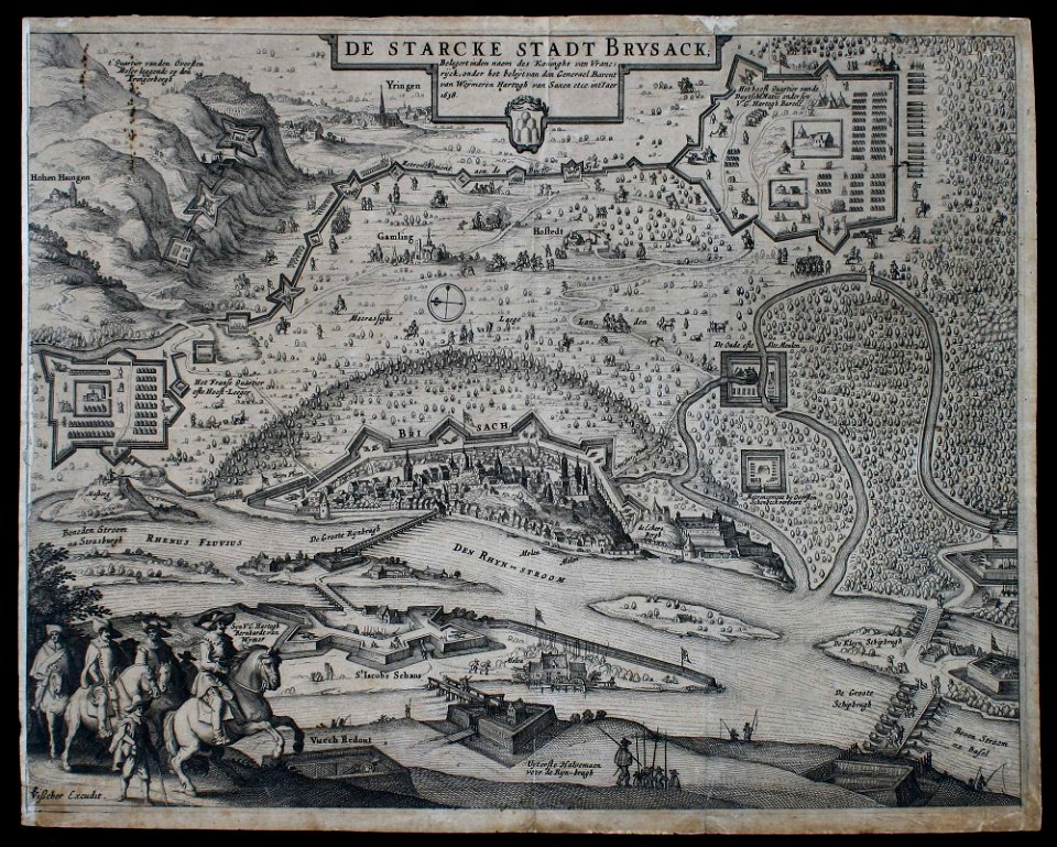
siege
maps with cartouches
atlas van der hagen
maps with cartouches
atlas van der hagen
maps with cartouches
atlas van der hagen
maps with cartouches
mount wutai
maps with cartouches
atlas van der hagen
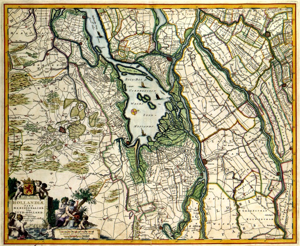
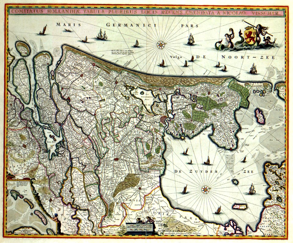
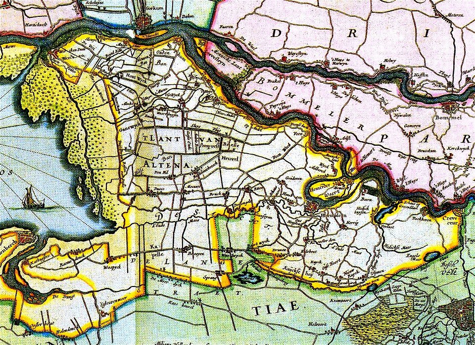
17th-century maps of the netherlands
maps with cartouches
17th-century maps of the netherlands
maps with cartouches
maps with cartouches
atlas van der hagen
17th-century maps of the netherlands
maps with cartouches
maps in the library of congress
d.c.,
17th-century maps of the netherlands
old maps of north brabant
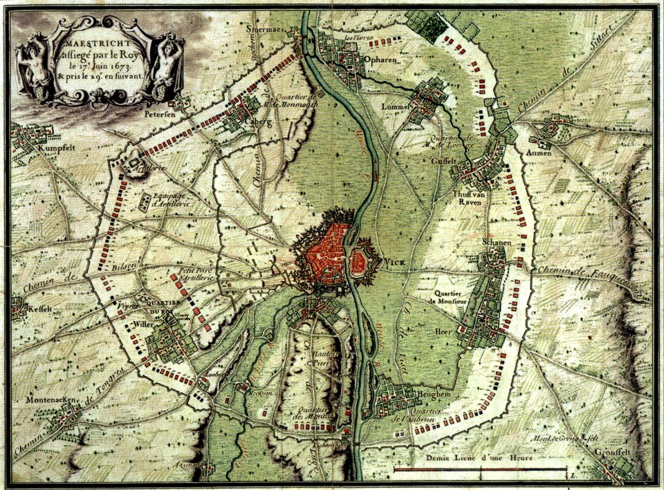
17th-century maps of maastricht
maps of the franco-dutch war
17th-century maps of maastricht
maps of the franco-dutch war
maps in the library of congress
d.c.,
atlante veneto (raremaps.com) volume 1
maps of the bay of kotor
atlante veneto (raremaps.com) volume 2
17th-century maps of piedmont
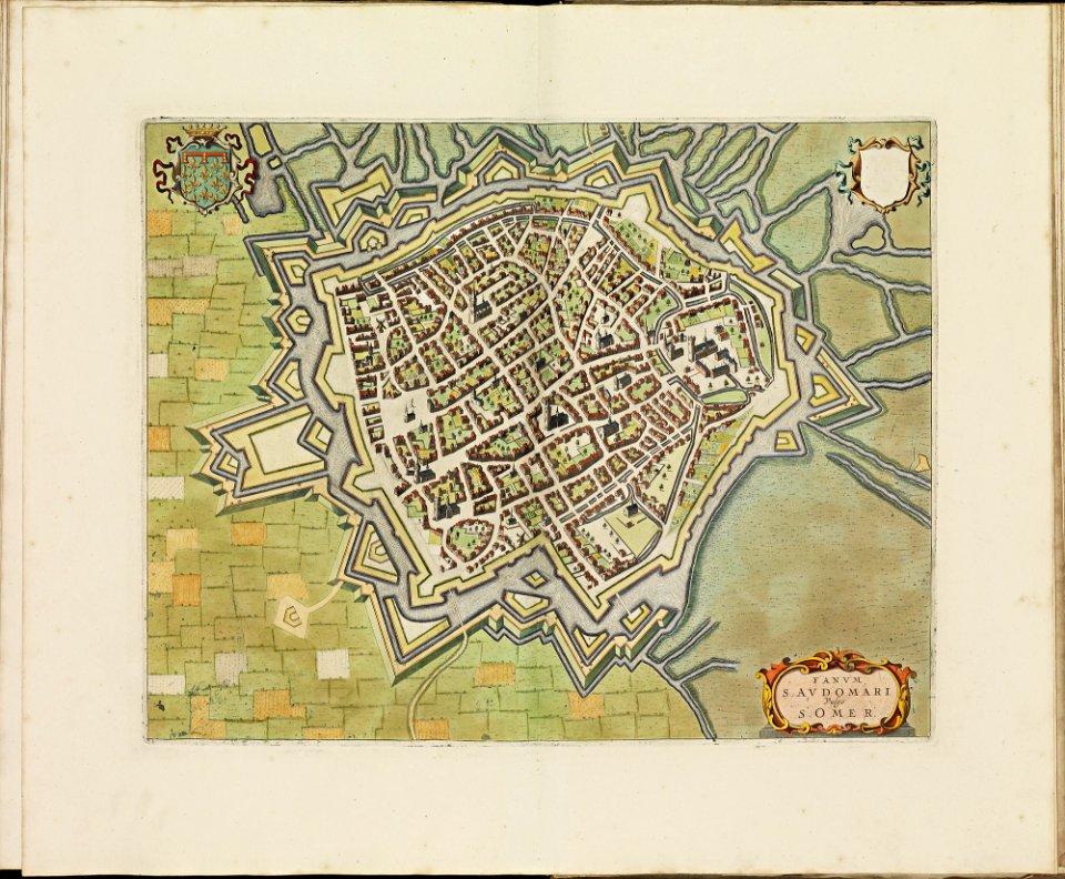
old maps of saint-omer
atlas de wit 1698
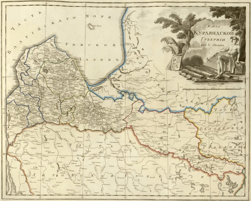
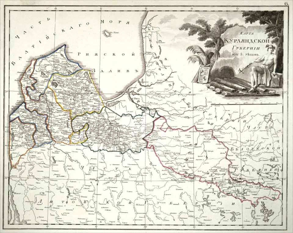
atlas of the russian empire (1800)
old maps of courland governorate
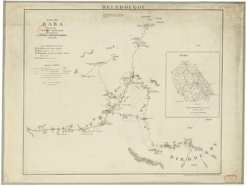
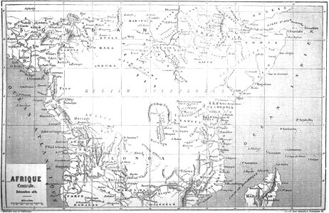
french colonization in africa
military maps
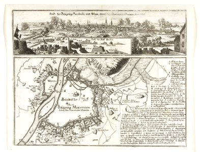
description des principales villes (1690)
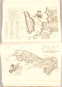
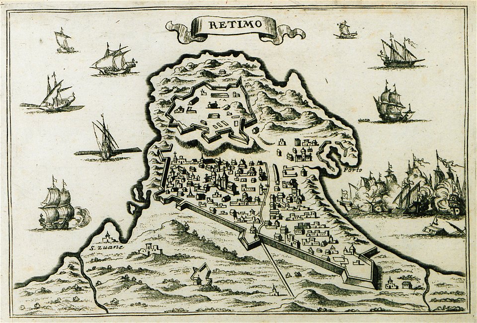
old maps of crete
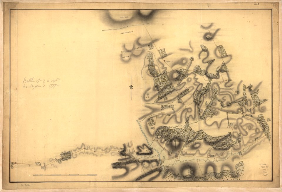
battle of brandywine
pennsylvania
battle of brandywine
pennsylvania
battle of brandywine
pennsylvania
battle of brandywine
pennsylvania
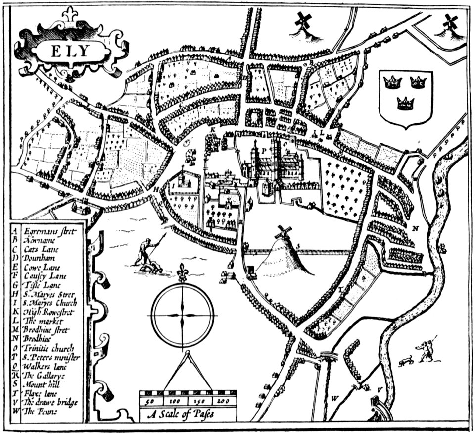
cambridgeshire
ely
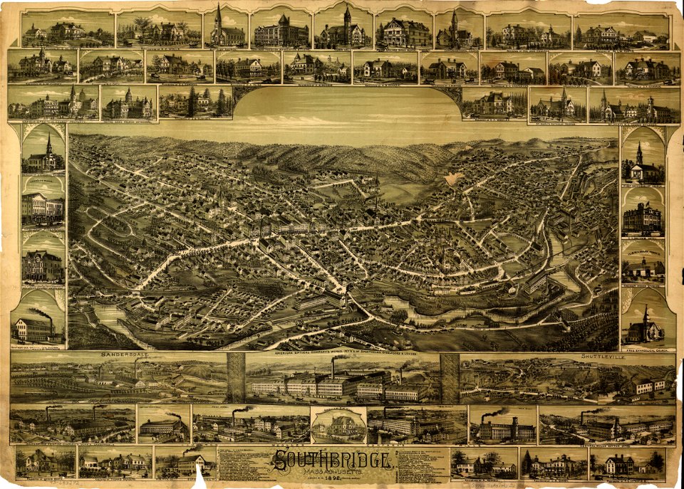
massachusetts
southbridge
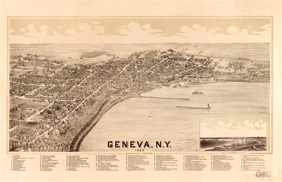
new york
geneva
16th-century maps of the black sea
maps made in the 16th century
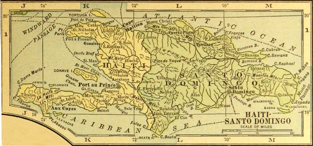
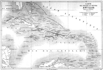
history of the dominican republic
old maps of haiti
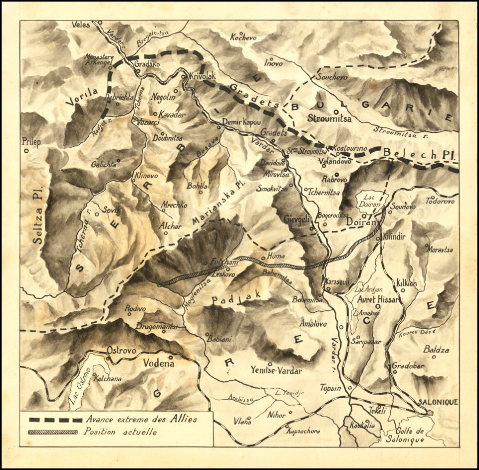
hand-drawn maps and views of world war i battlefields by h.m.
macedonian front maps
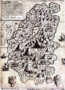
provided by landsbókasafn íslands
maps made in the 16th century
harvard university
pictorial maps
media in the houghton library
harvard university
provided by landsbókasafn íslands
maps made in the 16th century
20th-century maps of india
india
old maps of dutch brazil
johannes vingboons
images from bristol past and present (1882)
old maps of bristol
volume 3 of le tour du monde
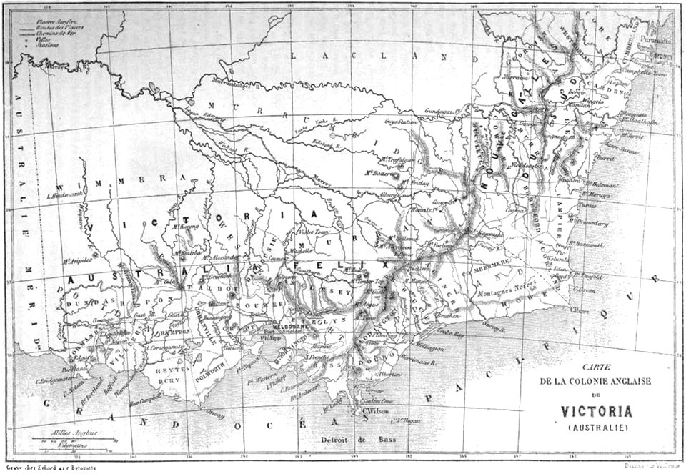
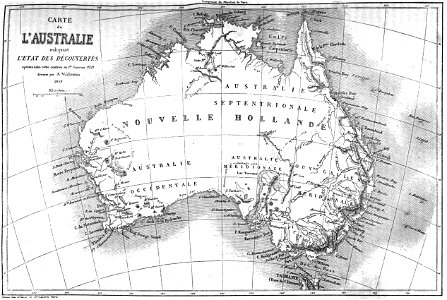
old maps of australia
volume 2 of le tour du monde
maps by alexandre vuillemin
maps of french indochina
maps of da nang
old maps of thailand
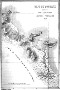
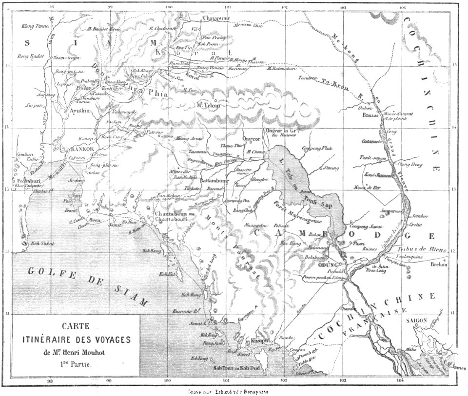
old maps of cambodia
volume 5 of le tour du monde
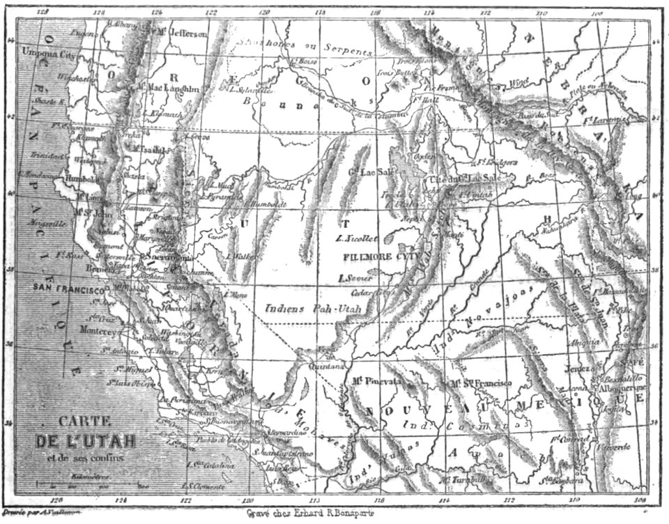
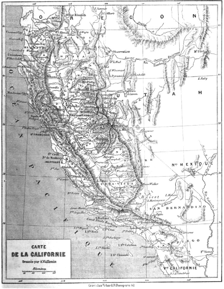
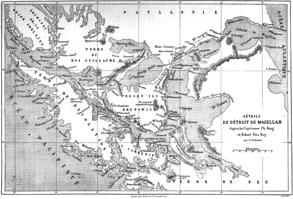
maps by alexandre vuillemin
volume 2 of le tour du monde
maps by alexandre vuillemin
volume 3 of le tour du monde
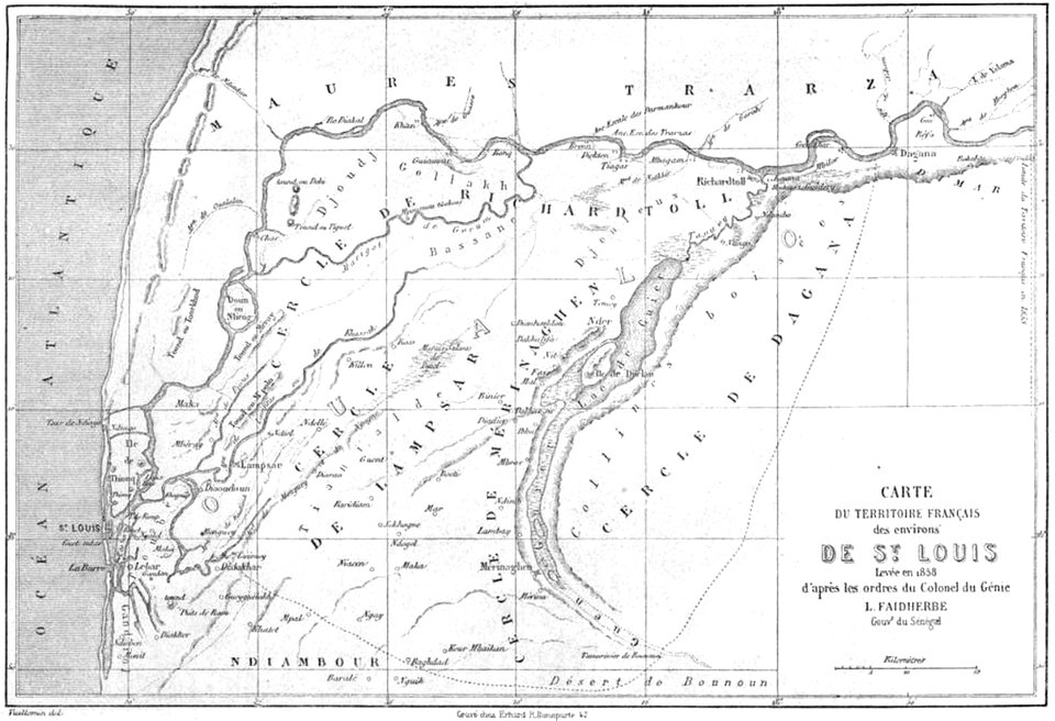
old maps of senegal
volume 5 of le tour du monde
old maps of africa
maps by alexandre vuillemin
old maps of australia
volume 3 of le tour du monde
old maps of senegal
maps by alexandre vuillemin
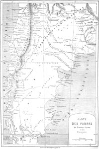
old maps of patagonia
maps by alexandre vuillemin
old maps of africa
volume 6 of le tour du monde
maps by alexandre vuillemin
volume 6 of le tour du monde
old maps of peru
volume 5 of le tour du monde
maps by alexandre vuillemin
volume 3 of le tour du monde
old maps of patagonia
maps by alexandre vuillemin
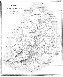
old maps of mauritius
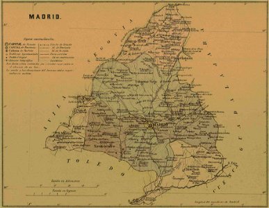
old maps of the community of madrid
1868 maps
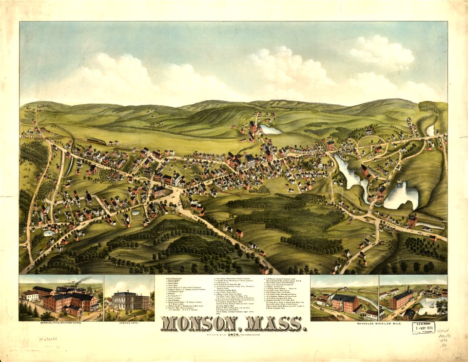
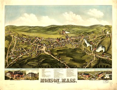
massachusetts
monson
massachusetts
monson
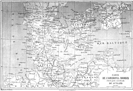
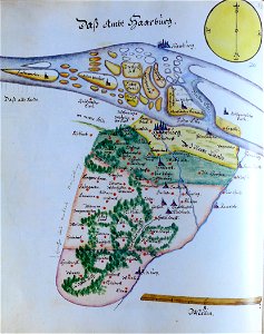
ämteratlas des fürstentums lüneburg von johannes mellinger
maps of elbe in hamburg
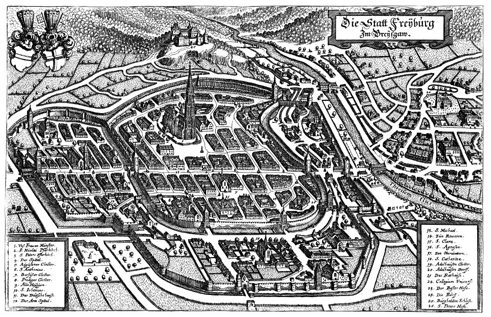
old maps of freiburg im breisgau
1644 maps
maps in russian state archives of ancient documents
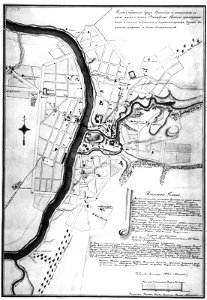
historical images of čerykaŭ
maps in russian state archives of ancient documents
historical images of viciebsk
maps in russian state archives of ancient documents
historical images of viciebsk
massachusetts
greenfield
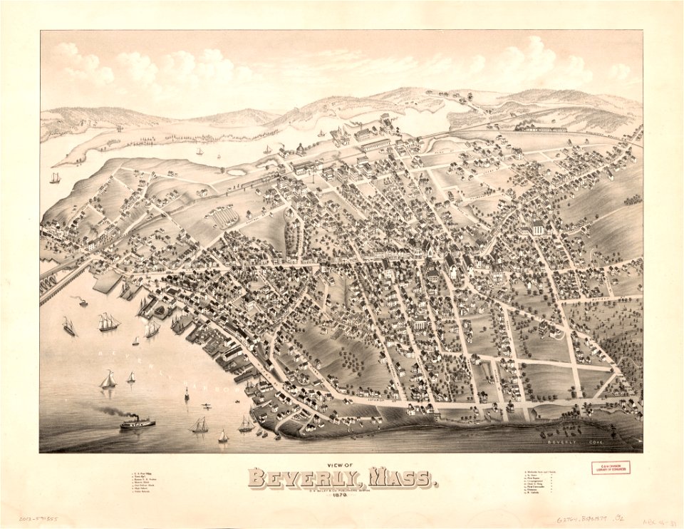
massachusetts
beverly
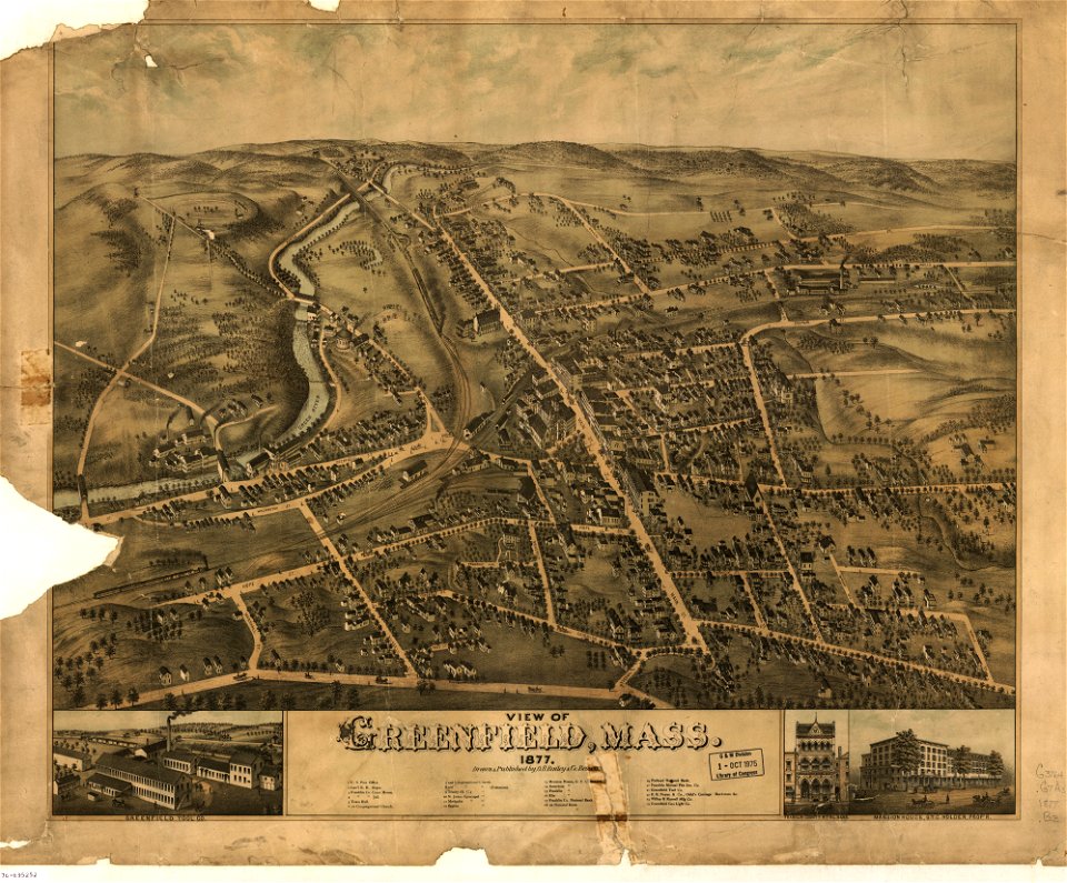
massachusetts
greenfield
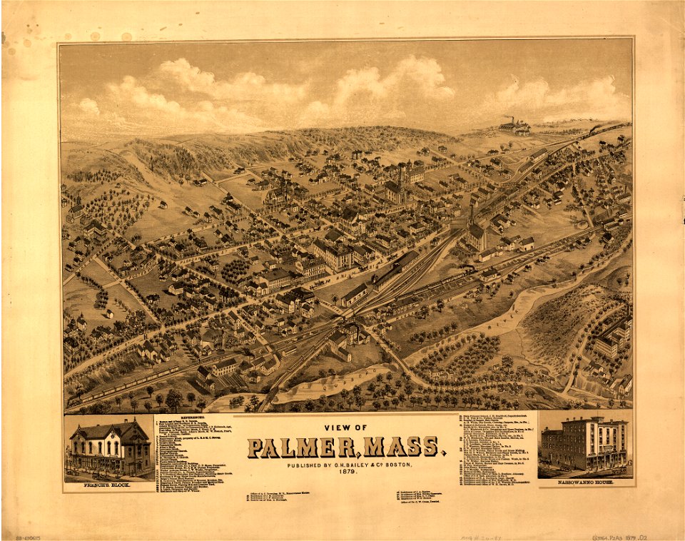
massachusetts
palmer
massachusetts
palmer
maps in the library of congress
washington
maps in the library of congress
washington
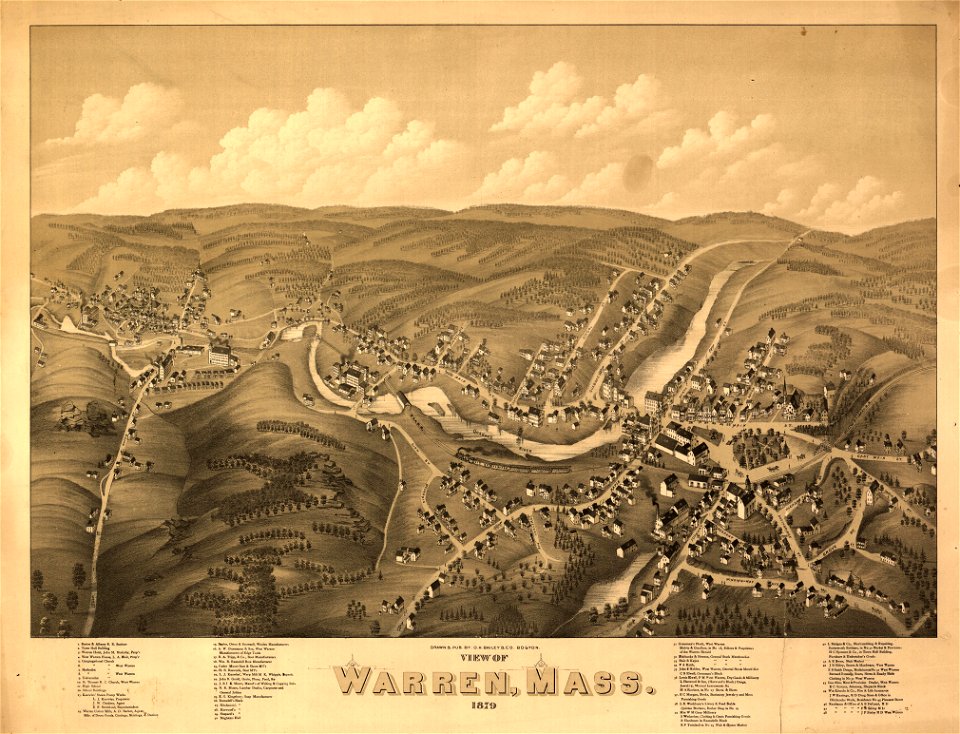
massachusetts
warren
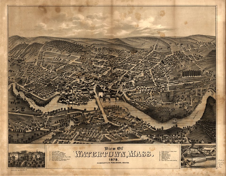
massachusetts
watertown
massachusetts
warren
maps in russian state archives of ancient documents
historical images of viciebsk
massachusetts
beverly
atlas of the russian empire (1792)
18th-century maps of estonia
maps in russian state archives of ancient documents
historical images of orša
cosmographia claudii ptolomaei alexandrini
latin-language maps
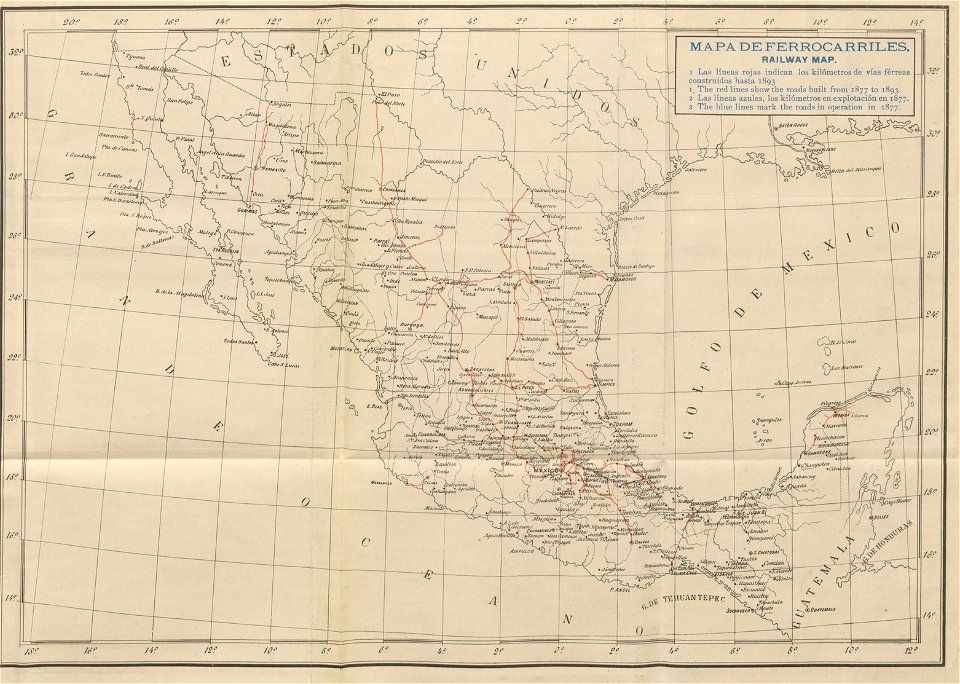
old maps of mexico
1893 in mexico
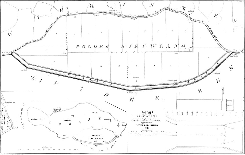
maps of polders in north holland
bouwkundige bijdragen
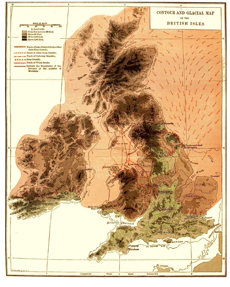
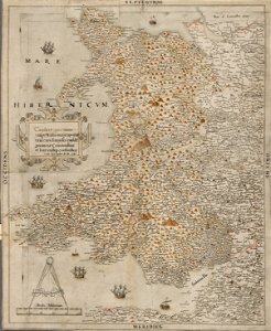
old maps of the british isles
1890s maps
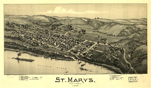
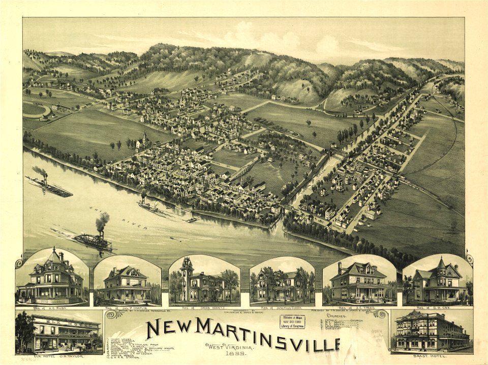
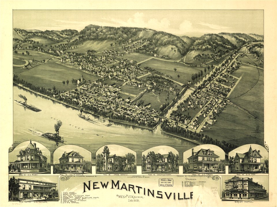
west virginia
st mary
west virginia
st mary
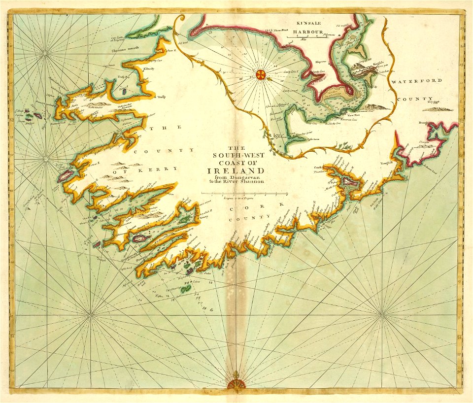
images from the new york public library
old maps of ireland
atlas of the russian empire (1800)
old maps of courland governorate
description des principales villes (1690)
old maps of crete
maps in the national library of wales
old maps of whole wales (alone)
atlas of the russian empire (1800)
18th-century maps of estonia
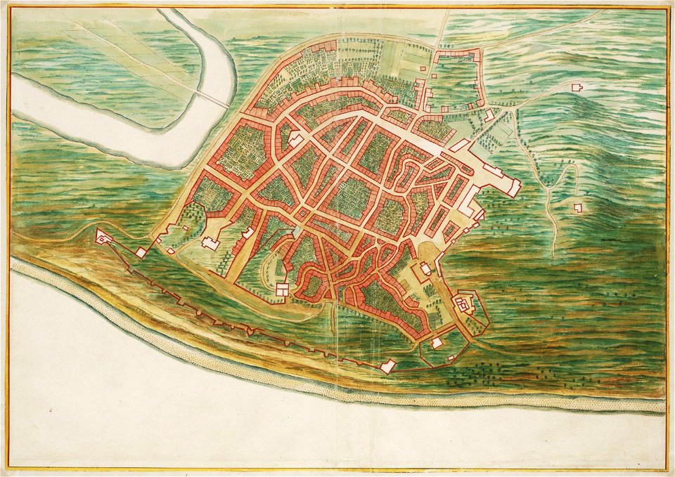
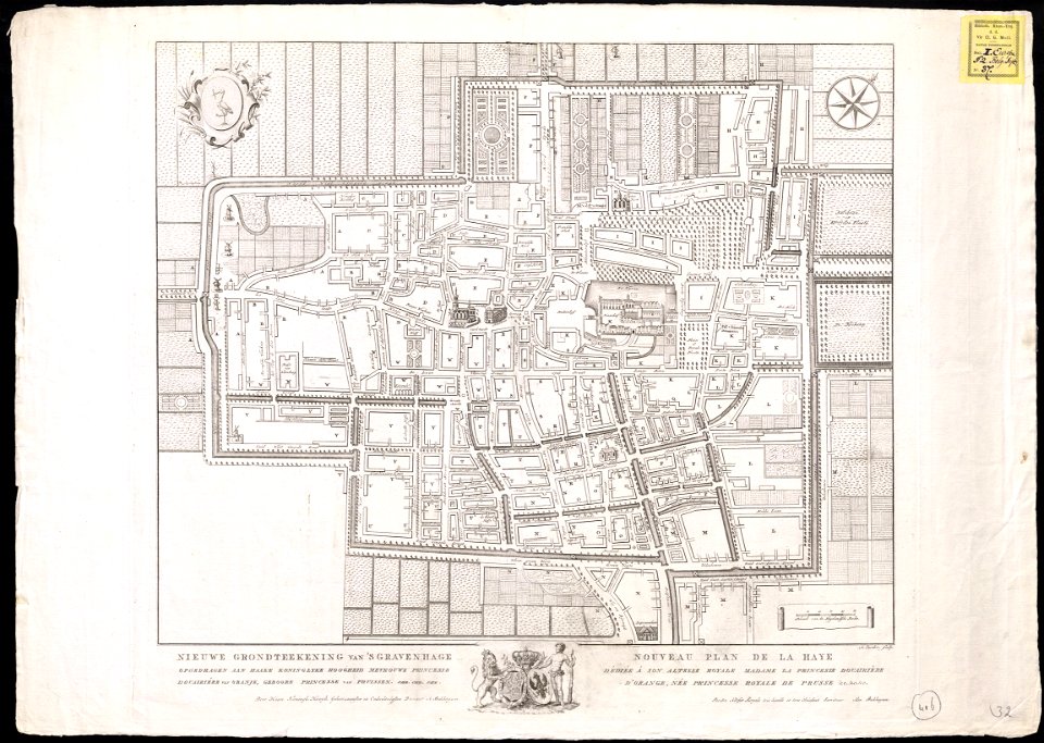
the hague in the 1840s
old maps of the hague
maps in the library of congress
west virginia
maps in the library of congress
west virginia
4601 - 4700 of 33,402
Next page
/ 335